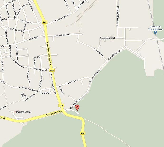
Darmstadt - Böllenfalltorweg
- Title:
- Darmstadt - Böllenfalltorweg
- Website:
- https://maps.app.goo.gl/HEMATZNrki9...
- Street:
- Böllenfalltorweg 10
- ZIP:
- 64287
- City:
- Darmstadt
- State:
- Hessen
- Country:
-

- Map:
 Show Darmstadt - Böllenfalltorweg on Google Maps
Description
Map: https://maps.app.goo.gl/HEMATZNrki9pJsNfA
By car:
Take the A5 from Frankfurt going south towards Darmstadt/Heidelberg. At the "Darmstädter Kreuz" switch over to A672 (direction: Darmstadt/Aschaffenburg) - this will run smoothly into Rheinstraße. Remember: "Böllenfalltor" is the name of the Darmstadt football stadium, so if you follow the signs with the black and white football - you're ON TRAIL!
Just before "flying over" the railway tracks, turn right into "Am Kavalleriesand". At the next possibility go left and almost immediately right (remember the football! or a sign with "Stadion" on). You are now on Haardtring. Stay on this road curving left at the Bahnhof "Darmstadt Süd", cross the B3 (Heidelberger Straße) , up the hill until you reach a T-junction. Turn right into Klappbacher Straße, ignore the big police station on the right and when you come to an intersection with traffic lights you will see the end of the tram line on the left. Go straight over the intersection and look for FH³ signs. The parking lot is at the end of a little no name road turning off to the right from Böllenfalltorweg about 50m behind the intersection. There are signs "DA Nordic Walking Treff" and "Pizzeria Zum Schützenhof" and hopefully, FH3 Hashers as well.
By public transport:
Take the S3 from Frankfurt Hauptbahnhof or Frankfurt Süd towards
Darmstadt (Attention Wankers: Do NOT get off at Wixhausen!). At the end
of the line (Hauptbahnhof Darmstadt) change to the tramline 2 and go to
"Böllenfalltor" (Endstation). Cross the road and look for FH3 Hashers.

Events


